The La Montée de Gers 2026 page brings together published data for this running route.
The route is listed from Sixt-Fer-à-Cheval, France to Samoëns, France, with 17.5 km and 978 m D+ on the page.
Listed organiser: Samoëns Trail Événements.
Start / area
Sixt-Fer-à-Cheval, France
Finish
Samoëns, France
Edition
2026
Distance
17.5 km
Elevation gain
978 m D+
GPX track and calculated values
Calculated values for this track: 17.5 km of distance calculated from the GPX track · 951 m ascent calculated with ign_rge_alti_wld.
Distance follows the GPX geometry; ascent uses elevations derived from ign_rge_alti_wld. These calculations remain separate from the organiser's figures.
Source-page value: 18 km; distance calculated from the GPX: 17.5 km.
Source-page value: 970 m ascent; ascent calculated with ign_rge_alti_wld: 951 m.
Documented checkpoints and aid stations
Aid stations or life bases: 1 · listed water points: 1 · checkpoints: 0.
Lac de Gers · km 8.2 — Full aid station.
Sources reviewed
Official sources: 12 · sources with a recorded review date: 12. Updates from the organiser always take precedence.
Latest recorded check: 8 October 2026.
Frequently asked questions
Is the La Montée de Gers GPX available?
Yes. The track and its profile can be viewed here, and the file is available as a free download from this page.
Do these details replace the organiser's instructions?
No. This page makes sources easier to consult and separates published data from GPX calculations. Check the latest official instructions before the start.
A point-to-point route from Sixt-Fer-à-Cheval to Samoëns via Gers, with a sustained climb, lake and hillside return before the final descent.
Identity — 2026 edition, 3 published points. Website figures: 18 km / 970 m ascent.
Rules — Follow the marking, retain waste and equipment, and report any withdrawal to race control. Reach the start-pen equipment check at least 20 minutes before starting. Crew support is limited to authorised stations; leave each checkpoint before its cutoff. Linked documents remain authoritative for registration, penalties and cancellation.
Course points — Station distance, altitude, cumulative ascent/descent and times come from the organiser’s table. Trailboard metrics come from the downloaded GPX. Dated times use Europe/Paris; a diversion checkpoint is not treated as an eliminating closure.
Coach: effort and terrain — Practise uphill hiking and technical descents, then rehearse shoes, carrying equipment and fueling on progressive outings. Start with a margin and keep an effort that allows eating; drink according to thirst, conditions and tolerance. Adapt load and taper to experience and recovery.
Coach: self-sufficiency — Size water and food for your expected time to the next confirmed station, plus a reserve; mandatory carrying capacity is not hourly consumption. Test products and keep an easy-to-eat backup. Body mass, target duration, sweat rate and gut tolerance are unknown, so no personal dose is prescribed.
Documents and weather — The attached briefing announces a heat kit and snow patches; it is retained as an edition document, not current weather. Check the organiser’s final instructions and fallback sections. Rescue access is not immediate everywhere.
Logistics — Bib collection at Base de Loisirs: Friday 19 June 10:00–20:00 for SDT and the Saturday formats; Saturday 04:00–06:00 for TDF, TDB and TDG; Saturday 10:00–20:00 or Sunday 06:00–08:00 for MDG and FDG. MDG and FDG start in Sixt: book the paid shuttle during registration, with no on-site booking.
Aid stations — Full stations list drinks, sweet and savoury foods; light stations have a smaller selection. Sixt adds a hot meal. Products may run out for later runners, so retain your reserve. Grenairon is described both as light aid and water-only: do not count on food without confirmation.
Crew and withdrawal — SDT and UTHG: organiser-provided 30 L bag for Sixt, deposited before the start at Place du Gros Tilleul and collected with your bib. No poles in the bag. Joux-Plane, Vallon and Sixt offer transport back; several refuges require walking down. Always inform race control before leaving the race system.
Entry — This format’s page lists €30, from category Espoir. This is the page’s 2026 price, not a future-edition guarantee. The rules require adults to provide an accepted FFA licence or valid PPS; for minors, check applicable documents and authorisations with the organiser.
Checks before the start
Read final instructions and equipment for the correct format
Collect your bib with ID and check required entry documents
Save the race-control number printed on your bib
Calculate self-sufficiency and cutoff margin between confirmed stations
Test GPX, lighting, shoes and fueling before race day
Arrange transport and return; book the MDG or FDG start shuttle if needed
Check the activated weather kit and any diversions
Differences and information still uncertain
These items are shown explicitly so an approximation is never presented as official data.
2026 reference checked on 9 October 2026; this dossier does not describe a future edition.
The rules retain 2025 prices and dates, and the 2026 equipment PDF shows distances different from race pages. The 2026 programme governs start times; equipment columns are identified by race code.
Station details and tracks can differ: Grenairon is a light aid station on the page but water-only on the track; Gers also appears on TMBD and TDG tracks without those codes in the general table. Food availability at these stations needs confirmation.
Fallback sections are not merged into the main track. Activation and cutoff changes remain the organiser’s decision.
Notable places
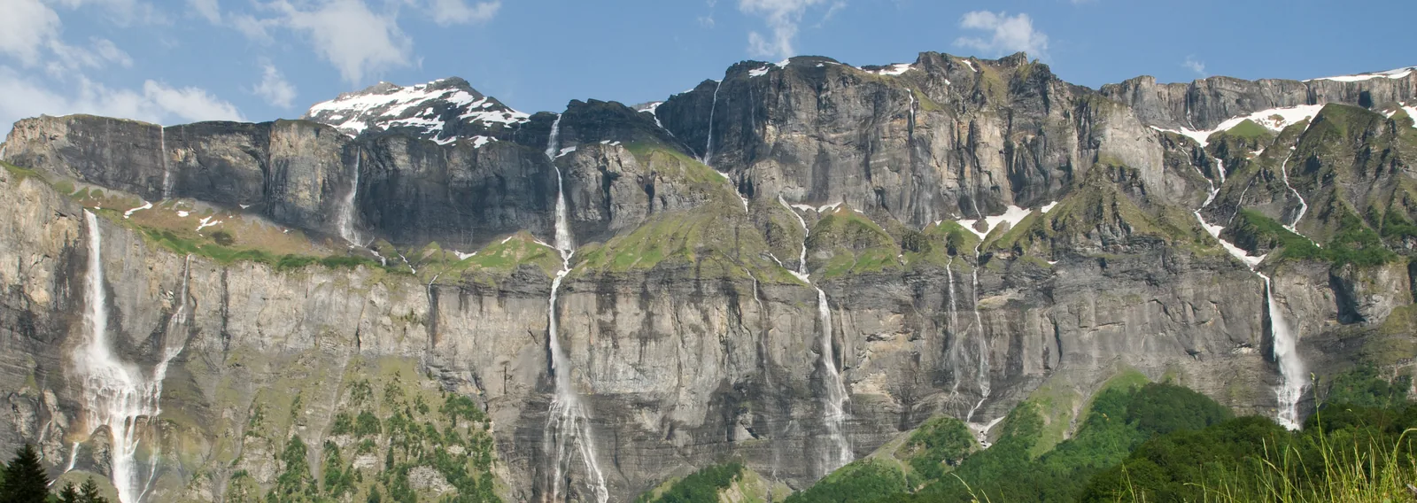
The Cirque du Fer-à-Cheval at Sixt-Fer-à-Cheval.SchiDD · CC BY-SA 4.0 · adapted image
Check the information
Sources and provenance
These links point to the documents used. The organiser's instructions remain authoritative if they change.

Race feedback
Have you already run this race?
Share your feedback: conditions, course marking, atmosphere, difficulty or tips for future participants.