Skip to Explorer content

TORX®

TOR330 — Tor des Géants®

Multi-day alpine race: the rules describe passages above 3,000 m, with conditions that may alternate between cold, wind, rain, snow, ice and heat.

September 13, 2026Courmayeur, Vallée d’Aoste, Italie

Distance
336 km
Elevation
+26,182 m

Loading route and elevation profile…

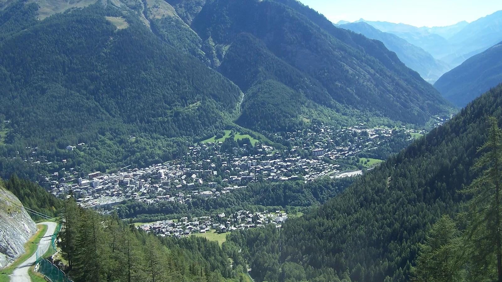
Courmayeur panorama, the start and finish of TORX’s TOR330 and TOR450.
Photo:X-WeinzarCC BY-SA 3.0 · adapted image

Route reference

Prepare the TOR330 — Tor des Géants® route

The TOR330 — Tor des Géants® 2026 page brings together published data for this running route.

The route is listed from Courmayeur, Vallée d’Aoste, Italie to Courmayeur, Vallée d’Aoste, Italie, with 336.5 km and 26,182 m D+ on the page.

Listed organiser: VDA Trailers.

Start / area
Courmayeur, Vallée d’Aoste, Italie
Finish
Courmayeur, Vallée d’Aoste, Italie
Edition
2026
Distance
336.5 km
Elevation gain
26,182 m D+

GPX track and calculated values

Calculated values for this track: 337 km of distance calculated from the GPX track · 24,796 m ascent calculated from GPX elevations.

These track measurements remain separate from the organiser's figures and depend on the GPX version and sampling.

  • Source-page value: 336.5 km; distance calculated from the GPX: 337 km.
  • Source-page value: 26,182 m ascent; ascent calculated from GPX elevations: 24,796 m.
Documented checkpoints and aid stations

Aid stations or life bases: 48 · listed water points: 6 · checkpoints: 0.

  • Baite Youlaz · km 12.8
  • La Thuile · km 19
  • Rifugio Deffeyes · km 27.9
  • Bivacco Zappelli · km 32.8
  • Col de la Crosatie · km 36
  • Planaval · km 42.8
  • BaseVita-Valgrisenche · km 48.5
  • Rifugio Chalet de L'epée · km 54.9
  • Rhemes-Notre-Dame · km 62.9
  • Col Entrelor · km 68.3
  • Eaux Rousses · km 78.3
  • Col Loson · km 90.6
  • Rifugio Vittorio Sella · km 95.2
  • BaseVita-Cogne · km 104
  • Goilles Dessous · km 109.8
  • Rifugio Dondena · km 126
  • Chardonney - Champorcher · km 131.6
  • Pontboset · km 139.4
  • BaseVita-Donnas · km 149.8
  • Perloz · km 155.6
  • La Sassa · km 162.9
  • Rifugio Coda · km 167.3
  • Rifugio della Barma · km 175.6
  • Lago Chiaro · km 180.9
  • Colle Della Vecchia · km 184.9
  • Niel - Dortoir La Gruba · km 190.5
  • Bleckene - Lòò Superiore · km 196.7
  • BaseVita-Gressoney · km 203.8
  • Rifugio Alpenzu · km 208.9
  • Champoluc · km 220.8
  • Rifugio Grand Tournalin · km 228.6
  • BaseVita-Valtournenche · km 237.5
  • Rifugio Barmasse · km 242.3
  • Bivacco Vareton · km 247.3
  • Rifugio Lo Magià · km 255.8
  • Rifugio Cuney · km 259.3
  • Bivacco R. Clermont · km 263.8
  • Oyace · km 274.7
  • Bruson Arp · km 278.7
  • Col Brison · km 280.3
  • BaseVita-Ollomont · km 286.5
  • Rifugio Champillon · km 291.2
  • Ponteille · km 297.7
  • Bosses · km 307.8
  • Rifugio Frassati · km 316.9
  • Col Malatrà · km 319
  • Rifugio Bonatti · km 324.6
  • Mont de la Saxe · km 330.2

Sources reviewed

Official sources: 2 · sources with a recorded review date: 2. Updates from the organiser always take precedence.

Latest recorded check: 17 September 2026.

Frequently asked questions

Is the TOR330 — Tor des Géants® GPX available?

Yes. The track and its profile can be viewed here, and the file is available as a free download from this page.

Do these details replace the organiser's instructions?

No. This page makes sources easier to consult and separates published data from GPX calculations. Check the latest official instructions before the start.

Reviewed information

Preparation and points to check

Race-day instructions

  • Single-stage event, at your own pace and semi-self-sufficient.
  • Aid stations are announced every 7 to 10 km; the detailed services at each aid station are not specified in the table.
  • The regulations state that the official personal bag is transported from one life base to the other.

Differences and information still uncertain

These items are shown explicitly so an approximation is never presented as official data.

  • The organiser page rounds the route to 330 km and 24,000 m D+; the official timetable gives 336.462 km, +26,182 m and −25,727 m, which are used here.
  • The official full GPX calculated in Trailboard is 337.346 km, +25,485 m and −25,483 m. Its metrics therefore do not replace those of the official table.
  • The file provided is named TOR330-Timetable-2026.xlsx, but its internal sheet is titled TOR330 Timetable 2025. The milestones are kept with this provenance stated explicitly.

Check the information

Sources and provenance

These links point to the documents used. The organiser's instructions remain authoritative if they change.

Race feedback

Have you already run this race?

Share your feedback: conditions, course marking, atmosphere, difficulty or tips for future participants.

No reviews yet. Be the first to share useful feedback.