
Hiking · France
Sentier de découverte de La Vernaz

Loading route and elevation profile…
Climb towards Plan de la Chaux
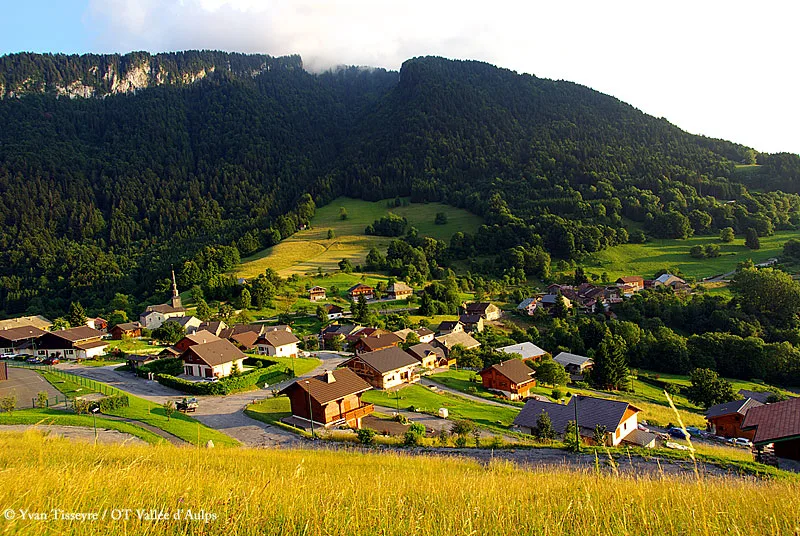
From the welcome board by the town hall car park, follow the paved road towards Plan de la Chaux. At the end of the road, continue for about 100 metres to the first drawing table, where you can stop to study the landscape.
Through the woods and the old quarry
Pass behind the concrete building and head downhill to the right. The trail’s interpretation panels introduce local trees and explain how to identify species or estimate their age. The forest path reaches the former pink marble quarry of La Vernaz.
Return via La Villaz and the church
After the quarry, follow the paved road to the right until the sharp bend before Gerdil, then turn left. The path crosses fields and a forest edge, passes a small stream and an orchard, and reaches La Villaz. Take the first uphill road towards the church and its final drawing table, then return to the village.
Notable places
At a glance
- Start
- La Vernaz, Chablais, Haute-Savoie
- Finish
- La Vernaz, Haute-Savoie
Plan your hike
Choose suitable conditions
The local tourism office describes an easy walk and recommends good weather. Follow the waymarking and adjust your pace to the terrain.
Vallée d’Aulps Tourism ↗Bring water and allow enough time
The local route page advises carrying water and setting out early enough to return before nightfall.
Vallée d’Aulps Tourism ↗Plan your hike
The tourist office recommends walking in good weather, bringing water and food, and setting out early enough to return before nightfall.
Official sources and resourcesDrawing tables and information panels mark the route; take time to stop and look at the landscape, trees and former quarry.
Official sources and resources
OpenStreetMap · relation 19410276 · © OpenStreetMap contributors · ODbL 1.0
This route geometry comes from OpenStreetMap relation 19410276, named “Sentier de découverte”, and forms a continuous loop. Vallée d’Aulps Tourism confirms the discovery trail, its town hall car park start and the described stages. The displayed metrics are calculated from the OSM GPX.
Race feedback
Have you already run this race?
Share your feedback: conditions, course marking, atmosphere, difficulty or tips for future participants.